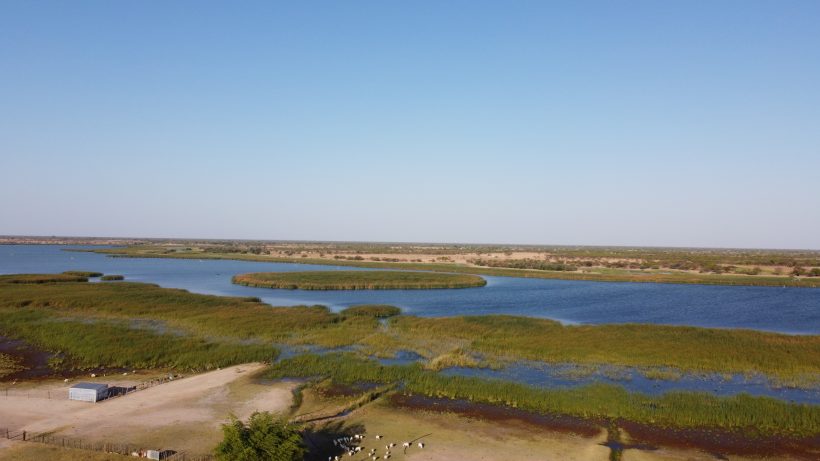
In a world increasingly being shaped by climate change, understanding the state of our natural ecosystems has never been more urgent. Wetlands, in particular, play a crucial role in maintaining ecological balance, offering essential services such as water filtration, carbon storage, and flood mitigation. But as climate change accelerates, these vital ecosystems are under threat.
It is against this background that SASSCAL through its WeMAST project developed a WeMAST Geoportal to safeguard the wetlands health and ensure sustainable management in southern African region. The WeMAST Geoportal which was conceptualize during the project’s Phase I and operationalized as well as enhanced in this current Phase II, is characterized with advanced technologies that provides comprehensive support for wetland management across several key areas such as field data collection ad validation; Monitoring Services; and Policy Support.
Moreover, the Geoportal is a platform distinguished by its ability to develop a comprehensive digital tool for wetland monitoring; bridging the gap for policymakers and non-experts; and empowering the concept of ‘From Data to action’. Designed for the main four river basins in SADC, the WeMAST Geoportal is a positive step towards building resilience across southern Africa in the face of Climate Change. Below is a breakdown of how the WeMAST Geoportal is a key aspect for monitoring wetland health in southern Africa and building resilience for the Future in the face of climate change.
A Digital Platform for Wetland Monitoring
The project, at its core, seeks to develop a comprehensive digital tool for wetland health assessment, leveraging data from Earth observation and ground-truthing methods. This ambitious initiative is centered around a user-friendly portal that allows stakeholders to visualize and query environmental data to understand wetland conditions across the region. The platform consolidates critical datasets—such as soil moisture, rainfall, land use, water quality, and flood susceptibility—into a single, accessible location.
According to the presentations made during the WeMAST Phase II End User Training workshop help online in November, 2024; as the project evolves, these datasets will be integrated into a robust database, enabling users to query data by year and season, offering insights into long-term trends. This will be instrumental in understanding changes in wetland health over time and identifying areas at risk due to environmental stresses, such as droughts, floods, and land degradation.
Bridging the Gap for Policymakers and Non-Experts
A significant challenge in environmental monitoring is ensuring that complex data is accessible to non-technical audiences. To address this, the platform includes summary documents and intuitive visualizations designed for policymakers, local communities, and other stakeholders who may not be familiar with geospatial data. These tools aim to present the information in an easily digestible format, helping users make informed decisions about wetland conservation and management.
Moreover, the portal includes an innovative QGIS plugin, which serves as a powerful tool for both professionals and researchers to visualize and validate environmental data in real time. This plugin is part of a broader effort to create a validated platform—one that not only presents accurate, up-to-date information but also offers tools for users to validate environmental conditions using their own field-collected data.
From Data to Action: The Role of Ground Truthing
One of the key features of this project is the incorporation of ground truthing, a method where data collected in the field is used to validate and refine remotely sensed data. Through a mobile application developed as part of the initiative, users can easily collect field data and upload it to the platform for analysis. This integration of in-situ data with satellite imagery and remote sensing datasets will ensure the accuracy and reliability of the environmental information presented on the platform.
Field workers, researchers, and even local communities across southern Africa can use the mobile app to monitor specific wetland features and report findings, which are then visualized on the platform. This direct link between field observations and digital data helps validate environmental conditions in a way that strengthens the platform’s credibility and usefulness.
A Focus on Southern Africa’s Transboundary Basins
The platform’s focus is on the four transboundary basins in the SADC region: Zambezi, Kuvelai, Okavango, and Limpopo. These areas are critical for regional water resources and the livelihoods of millions of people. By monitoring wetland health in these basins, the platform aims to assess vulnerability to climate change and identify opportunities for building resilience.
In particular, the platform uses a set of key indicators—such as exposure, sensitivity, and resilience indicators—to measure the impacts of climate-related changes in the wetlands. Exposure indicators monitor the extent of environmental changes, while sensitivity indicators assess the vulnerability of the wetlands to those changes. Resilience indicators, on the other hand, help evaluate the capacity of these wetlands to recover from disturbances.
A Step Toward Building Resilience
The overarching goal of this project is to build resilience in the face of climate change. By understanding how wetlands are affected by shifting weather patterns, land use changes, and water management practices, the platform provides critical data for informed decision-making. This, in turn, will guide efforts to manage wetlands sustainably, ensuring that they continue to provide essential ecosystem services for future generations.
In the face of increasingly scarce natural resources and climate shocks, the ability to monitor and assess wetland health is crucial. Wetlands are not just environmental assets; they are also integral to the livelihoods of communities in the SADC region, providing water, food, and protection from natural disasters. By tracking their health, we can better understand how to manage these resources and ensure they remain viable for years to come.
The Road Ahead
As the platform continues to evolve, the team behind this initiative is committed to expanding its functionality and outreach. The development of training materials, manuals, and user guides will empower even more users—whether field researchers or government officials—to effectively use the platform and contribute to wetland conservation efforts.
Through continued collaboration, innovation, and engagement with local communities, the project hopes to set a standard for wetland monitoring and environmental assessment across the southern African region. By harnessing the power of Earth observation and ground-truthing, it is possible to better understand our wetlands, protect them from the impacts of climate change, and build a more resilient future for all.


Leave a Reply