The African Union Commission (AUC) has applauded the Southern Africa Science Service Centre for Climate Change and Adaptive Land Management (SASSCAL)’s Wetland Monitoring and Assessment Service for Transboundary Basins in Southern Africa (WeMAST) project for the progress made in 2022 on its Implementation Action Plan in enhancing an operational Geoportal and executing Earth Observation Capacity Building.
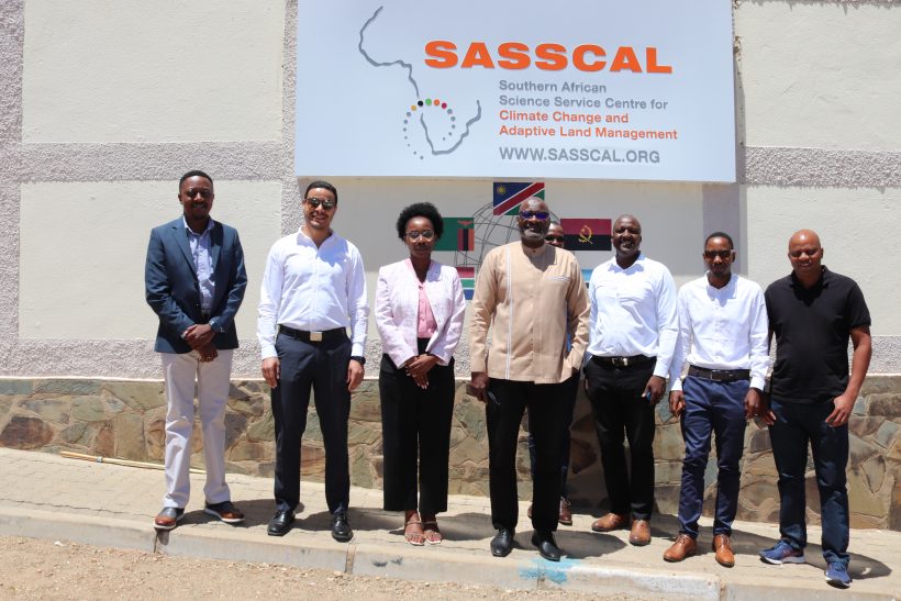
This is following the Two (2) days “GMES & Africa Monitoring Mission” that took place from 20-21 February 2023 at the SASSCAL Secretariat Regional Office in Windhoek, Namibia. Dr Budzanani Tacheba, SASSCAL’s Director of Science & Technology and Capacity Development welcomed Dr Saley Bachir the Senior Scientific Officer for AUC and his counterparts for their mission to Namibia.
The Global Monitoring for Environment and Security and Africa (GMES & Africa) monitoring mission carried out by the AUC, aimed to assess the progress made towards agreed targets including activities and approved execution plans for the year 2022, to analyze and validate the results for the WeMAST products and services, provide the necessary support and advice on the attained result projects and successes as well as discuss the implementation plan for 2023.
The AUC lead by in its feedback remark to the operations of SASSCAL’s WeMAST asserted the progress made towards the actualization of the products and services around the Monitoring and Assessment of Wetlands as well as the translucent information the overall operations and budget utilization of the funds.
SASSCAL’s WeMAST project under the GMES & Africa is jointly funded by the African Union Commission through a partnership with the European Union. For the year 2022 an amount of € 300 000 Euros which is equivalent to about N$ 4.8 Million in Namibian dollars, was utilized to launch WeMAST Phase II, products and services linked to capacity building on Earth Observation Applications in monitoring and assessment of wetlands.
Most importantly the Geoportal and trainings of Earth Observation to river basin organizations, national water and environment authorities, academic and research institutions, private sectors, local community representatives, non-governmental organizations women and men in natural and water resources management.
Caring over from WeMAST Phase 1 is the Geoportal which will be upscaled and operationalized in WeMAST Phase 2. The Geoportal is a software platform that can be accessed online, which will support sustainable wetland assessment and monitoring services.
The Geoportal focuses on generating user information from the Four targeted River basins, namely the Cuvelai, Limpopo, Okavango and Zambezi River Basin, that would include:
- Wetlands inventory (Mapping extent, floodplains, swamps, marshes, and other surface water bodies),
- Information on water cycle regimes (duration, extent and timing of flooding),
- Information on Vegetation Dynamics
- Inland water quality mapping dynamics (algal blooms and Total suspended matter), and
- Wetland utilization and landcover information.
WeMAST Phase 2 will thus concentrate on the upscaling of the Geoportal to make it more user friendly, to operationalize it by making sure the end users are aware and have access to it, as well as intensify the Earth Observation capacity building on Applications in wetlands, data access and pre-processing using cloud computing platforms as well as the overall EO wetland products and services validation.
Women in Southern Africa are strongly encouraged to participate and register for Earth Observation training in Wetlands Monitoring and Assessment.


Leave a Reply