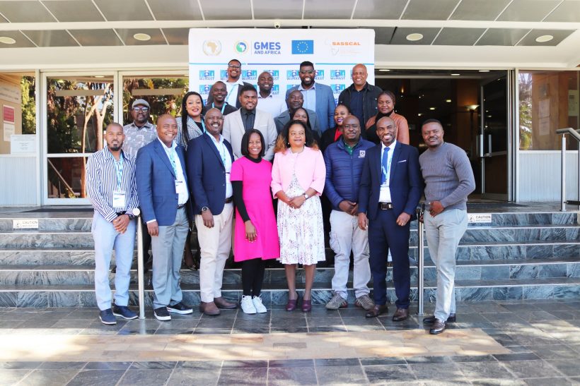
Pretoria, South Africa – Earth Observation (EO) and space-based technologies are playing an increasingly pivotal role in shaping Africa’s sustainable development agenda. This was the central message of the GMES and Africa Southern African Regional Workshop, co-hosted by the Southern African Science Service Centre for Climate Change and Adaptive Land Management (SASSCAL) and the Council for Scientific and Industrial Research (CSIR).
Held under the theme “From Data to Impact: Earth Observation and Space Technology Solutions as a Catalyst for Enhancing Africa’s Policy and Economic Transformation,” the event drew key stakeholders from across government, academia, civil society, and the private sector. It showcased innovative solutions and tools that are transforming environmental governance and regional cooperation across Southern Africa.
Prof. Indongo: EO Central to Evidence-Based Policy
In her opening remarks, SASSCAL Executive Director Prof. Nelago Indongo emphasized that EO technologies, particularly through initiatives like the GMES and Africa Programme, are not merely scientific tools, but powerful enablers of data-driven decision-making and sustainable policy development.
“The GMES and Africa initiative is more than a space programme it empowers Africa to respond to climate challenges with real-time, evidence-based tools,” said Prof. Indongo, noting that services such as the WeMAST Geoportal have had tangible impact in environmental monitoring and wetland management.
WeMAST II: Wetlands, Technology, and the SDGs
At the heart of SASSCAL’s regional efforts is the WeMAST II project a flagship wetland monitoring initiative that aligns directly with multiple UN Sustainable Development Goals (SDGs) and the African Union’s Agenda 2063. Through partnerships with institutions across Namibia, Botswana, Zambia, Zimbabwe, and South Africa, WeMAST uses satellite imagery, geospatial data, and ground validation to track and manage wetlands in the Zambezi, Limpopo, Okavango, and Cuvelai river basins.
Dr. Innocent Chomba, SASSCAL National Programme Coordinator, highlighted the WeMAST Geoportal as a core innovation, providing access to real-time data on land cover, soil moisture, water quality, and flood susceptibility. “We are turning data into insights and empowering decision-makers to protect ecosystems across national borders,” he said.
Prof. Timothy Dube: From Satellites to Insights
Prof. Timothy Dube, a technical lead from the University of the Western Cape, demonstrated how EO data, including Sentinel and Landsat imagery, is enabling continuous, detailed monitoring of wetland dynamics over decades. He showcased how advanced data fusion, cloud computing, and digital platforms such as Google Earth Engine and Sentinel Hub are transforming environmental assessments across the region.
“EO is not just about access to data it’s about building institutional capacity and technical tools that can convert that data into meaningful impact,” Prof. Dube emphasized.
Digital Innovation and Partnerships: Mr. Albano Santos’ Perspective
Albano Santos, a software developer at SASSCAL, underlined the importance of cross-border digital collaboration. He emphasized how the Soil Moisture Index (SMI) and other EO tools are helping commissions like CUVECOM manage climate risks in vulnerable basins such as the Cuvelai.
“The WeMAST platform is not just about satellites it’s about shared decision-making, regional partnerships, and community engagement,” Santos explained. The project is supported by a network of regional institutions and global partners, including the EU Joint Research Centre (EU-JRC), RCMRD, and CSE Senegal.
Advancing Policy and Institutional Frameworks
Dr. Budzanani Tacheba, SASSCAL’s Director of Science, Technology and Capacity Development, presented major policy milestones, including the signing of five MoUs and the formation of nine strategic partnerships. These collaborations are anchoring EO services into regional governance structures and enhancing interoperability of the WeMAST Geoportal.
“Building inclusive, future-ready frameworks through gender-sensitive capacity building and institutional engagement is central to sustaining our environmental management efforts,” Dr. Tacheba said.
Basin Vulnerability Index: A New Strategic Tool
A highlight of the workshop was the introduction of the Basin Vulnerability Index (BVI) by Dr. Chomba. Integrating indicators such as NDVI, SPI, SMI, and SOM, the BVI is a critical tool for assessing ecosystem stress and guiding interventions.
“The BVI is not just a map it’s a strategic tool that informs real decisions about where and how to act,” Dr. Chomba noted, adding that such innovations are key to protecting Southern Africa’s rapidly degrading wetlands.
A Unified Path Forward Under AfSA
The workshop also marked a major institutional shift as the GMES and Africa Programme transitions under the leadership of the newly formed African Space Agency (AfSA) a move expected to streamline EO initiatives across the continent.
As climate change continues to challenge the region’s development efforts, SASSCAL reaffirmed its commitment to expand EO services, deepen regional cooperation, and contribute to Africa’s long-term climate resilience.
“We are building a future where science serves the people collaborative, data-informed, and regionally connected,” said Santos in closing.


Leave a Reply