In the heart of southern Africa, where wetlands are vital to both the environment and local communities, a significant initiative was born to enhance the region’s capacity for sustainable wetland management. Given birth by SASSCAL and its consortium, the Wetlands Monitoring and Assessment Service for Transboundary River Basins (WeMAST) is transforming how stakeholders access; validate and utilize Earth Observation (EO) data for wetland monitoring in the Zambezi River Basin. Central to its success is the engagement of diverse users—policy makers, experts in river base management, local communities, researchers, private sector players, and even tourists—whose collective input is shaping the future of this project.
WeMAST is a flagship project funded under the Global Monitoring for Environment and Security (GMES) & Africa Support Programme, a collaborative effort between the African Union and the European Commission. This initiative aims to build local capacities in the use of Earth Observation, enabling African nations to effectively manage and monitor their environments, with a strong focus on sustainable development.
A Geoportal for All
This flagship project developed -the WeMAST geoportal which is a key tool for accessing Earth Observation data. The geoportal’s role is pivotal, offering high-resolution imagery and a user-friendly interface that provides up-to-date, near real-time data for decision-makers across the four-river basin: Zambezi; Limpopo; Okavango; Cuvelai River Basin. In its developing stage during the phase I of the WeMAST project, the platform had basic features which were later on upgraded to feature advanced datasets, including additional ancillary data, and offers the ability to deliver real-time updates on wetland conditions. These new enhancements make it easier for users to visualize and interpret wetlands data, thus fostering better decision-making processes.
An equally significant development is the mobile app for WeMAST, developed by SASSCAL and its technical partners. This mobile platform enables users to access crucial data on the go, making Earth Observation tools even more accessible and practical for those working in the field, such as environmental officers and local communities. The app represents a major leap in the accessibility of wetland monitoring data, putting powerful tools directly into the hands of users, wherever they are. This gives room to near real time access to the EO data on the geoportal.
Engaging Stakeholders: A Collaborative Approach
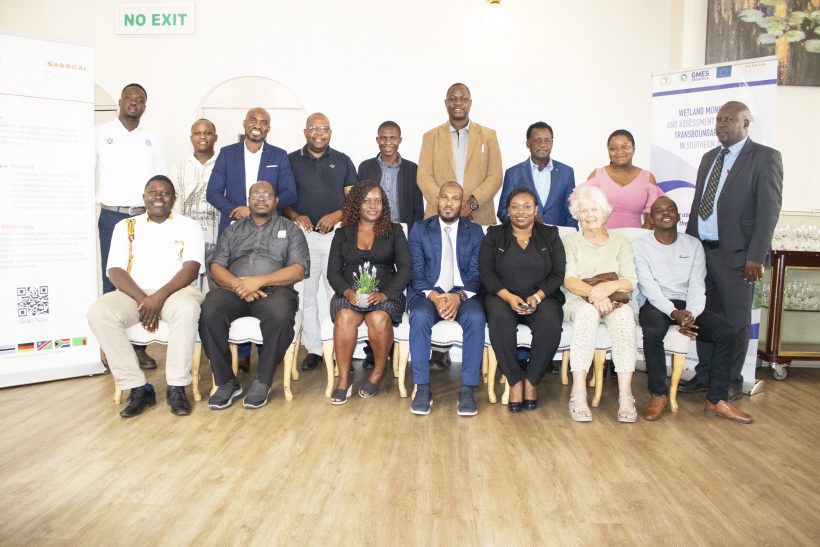
The success of WeMAST hinges on its ability to engage a wide variety of stakeholders, each of whom brings a unique perspective to the table. During recent consultations, stakeholders from across the region gathered to contribute their insights into the project’s upscaling process.
Among the attendees of these stakeholders’ engagements include: representatives from the Zambezi Watercourse Commission (ZAMCOM); Cuvelai Watercourse Commission on groundwater management (CUVECOM); Limpopo Water Commission (LIMCOM); Okavango River Basin Water Commission (OKACOM); non-governmental organizations (NGOs), and local communities who rely on wetlands for their livelihoods. These groups are essential in ensuring that the tools being developed are practical, relevant, and truly reflective of the challenges faced by those on the ground. By attending workshops and engaging in discussions, these stakeholders help identify user needs and preferences, which will directly inform the further development of the WeMAST tool.
Other sectors involved throughout the phase II include tour operators, who are primary wetland service users and active participants in citizen data collection. They not only contribute valuable data but also act as intermediaries between the scientific community and local populations, ensuring that data integrity is maintained while fostering local engagement. Their involvement plays a crucial role in the project’s citizen science aspect, which allows for more robust and reliable data collection on wetland health.
Data Quality and Security: Protecting the Integrity of Information
The discussions surrounding the upscaling of the WeMAST geoportal also focus on data quality control and security. Stakeholders have emphasized the importance of having reliable, high-quality data, particularly given the diverse range of users who rely on the information to make informed decisions. One of the key outputs from these discussions is the creation of Zambezi Basin-specific indicators that reflect the unique wetland characteristics of the region.
Equally important is ensuring that data security measures are in place. With citizen scientists contributing data, it is essential that their privacy and the integrity of their information be protected in compliance with relevant data protection regulations. This focus on security ensures that users—whether they are local communities or data providers—can trust the system and feel confident in their participation.
Building Capacity for the Future
The user engagement meetings also highlight the importance of training and capacity building. As the WeMAST geoportal evolves, there is a clear need to ensure that users are not only able to access the data but are also equipped with the skills to make the most of it. Training programs have been implemented in Namibia; Botswana; Zambia and Zimbabwe, and more are being designed to help stakeholders—from policymakers to local practitioners—better understand how to interpret the data, apply it to real-world scenarios, and contribute meaningfully to the ongoing development of the system.
This collaborative, user-centered approach is a cornerstone of the WeMAST project. By gathering input from a wide array of stakeholders and ensuring that the geoportal is tailored to meet the specific needs of its diverse users, the project is paving the way for more effective and sustainable wetland management in the four basins and beyond.
The WeMAST project’s emphasis on user engagement is what sets it apart. By prioritizing the input of stakeholders at every level—from local communities to high-level policymakers—the project is ensuring that the tools and services it develops are not only effective but are also responsive to the unique needs of the Zambezi River Basin. As the geoportal continues to evolve, the collaborative efforts of all involved will ensure that it remains a vital resource for sustainable wetland management in Southern Africa.


Leave a Reply