From the winding floodplains of the Zambezi River to the lush Okavango Delta, wetlands are lifelines in southern Africa. They serve as ecological treasures and engines of local economies, supporting agriculture, fisheries, and urban livelihoods. But with increasing climate variability, population pressures, and land-use changes, these vital ecosystems face unprecedented threats. Now, thanks to technological advancements and strategic partnerships, Earth Observation (EO) data is emerging as a powerful tool to protect wetlands and drive sustainable economic growth.
At the heart of this transformation is the Southern African Science Service Centre for Climate Change and Adaptive Land Management (SASSCAL), through its WeMAST project-the Wetlands Monitoring and Assessment using Earth Observation initiative. Funded by the African Union Commission and the European Union under the GMES & Africa Programme, WeMAST is redefining how wetlands are monitored, managed, and protected.
A New Perspective on Wetlands
Earth Observation (EO) data, derived from satellites, drones, and remote sensing tools, provides a bird’s-eye view of wetlands and surrounding landscapes. Through consistent and wide-scale monitoring, EO data offers insights that were previously inaccessible, such as seasonal flooding patterns, land cover changes, and water quality fluctuations. These insights are critical for both conservation and planning.
Wetlands do not exist in isolation, their health impacts food security, biodiversity, and even the local economy. With EO data, we’re now able to track the pulse of these ecosystems in near real time.”
The WeMAST Geoportal: Data for All
Central to the initiative is the WeMAST Geoportal, an online platform that provides free and open access to EO data and wetland-related information. Through this portal, users from government agencies, academia, NGOs, and even local farmers can visualize, analyze, and download data relevant to their work.
Accessible in multiple southern African countries, the geoportal is already playing a pivotal role in shaping decisions on land use, conservation, and infrastructure development.
In Namibia for instance the authorities in the Northen Part of the country particularly Oshakati Town Council are using the WeMAST geoportal in mapping and urban planning; preparations for natural disaster such as floods and wild fires.
Empowering Communities, Boosting Economies
The implications of EO data go beyond conservation they are also boosting livelihoods.
In agriculture, for example, satellite data helps farmers understand soil moisture trends, predict rainfall, and manage irrigation more efficiently. This is crucial in floodplain farming systems, where the timing of planting and harvesting is dictated by water availability.
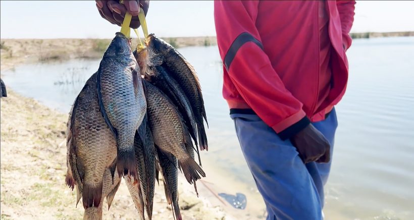
In fisheries, EO data tracks changes in water bodies, enabling sustainable fishing practices. Before the use of EO data farmers in southern Africa used to just fish blindly but now the data from EO helps them to strategize themselves and maximize yields. “We used to fish blindly,” said Ndapa Mwiinga, a fisherwoman in Oshakati. “Now we know when the waters are low, where the fish migrate, and which areas to avoid for breeding.”
And in urban planning, local governments are using WeMAST data to design cities that grow with resilience. Avoiding wetland encroachment not only preserves biodiversity but also prevents costly flood damage.
Climate Resilience for the Future
With climate change intensifying, the role of wetlands as carbon sinks and natural buffers against extreme weather becomes even more critical. Earth Observation helps quantify these services, making it easier for Southern African countries to integrate wetlands into their climate adaptation and mitigation strategies.
A Shared Vision, A Shared Responsibility
By democratizing access to EO data, the WeMAST project is fostering a culture of evidence-based decision-making across Southern Africa. It’s a model of how science, policy, and community action can align to protect natural resources while unlocking economic potential.
As wetlands continue to face pressure from development and climate change, the work of SASSCAL and its partners serves as a reminder: when we invest in data, we invest in people, nature, and the future.
Explore the WeMAST Geoportal and learn more about how Earth Observation is shaping a sustainable Southern Africa at: http://gmes-wemast.sasscal.org


Leave a Reply